Why does Amsterdam, the picturesque capital of The Netherlands, boast such an intricate network of canals?
Explore the Amsterdam canals and uncover their history, highlights and impact on the city
As a resident deeply familiar with the city’s waterways, I provide insights into this question and answer nine other common queries about the Amsterdam canals.
Visitors can join me on this journey to discover why Amsterdam’s identity is deeply tied to its beautiful and functional canals.
Table of Contents
Read on to learn more about the fascinating background of the Amsterdam canals, or click on the question that interests you most.
Amsterdam is a city well below sea level and in the middle of a former peat swamp
1. Why Are There Canals In Amsterdam?
Let’s start with the most obvious question first. Why are there canals in Amsterdam?
There are canals in Amsterdam for continuous water drainage to avoid flooding. Amsterdam is located ± 0.5 meters below sea level and would be underwater without constant drainage. The canals in Amsterdam were also used for the transportation of goods, defensive purposes, and the discarding of sewage.
The canals in Amsterdam are man-made. Amsterdam is located well below sea level and in the middle of a former peat swamp. Amsterdam needed canals to avoid flooding and survive as a city.
Read on to learn how the Dutch dug those canals to be able to build Amsterdam in the middle of a swamp and create one of the most admired cities in history.
2. History Of Amsterdam Canals?
Amsterdam’s intricate canal system and dikes were crucial in protecting the city, which sits 0.5 meters below sea level, from flooding.
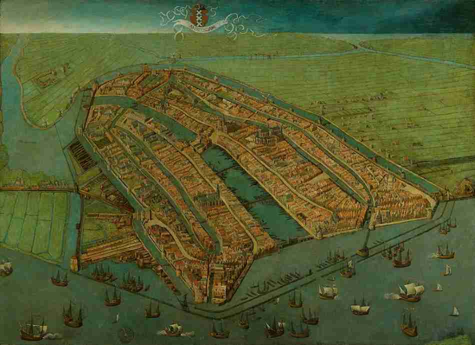
Amsterdam, located in a peat swamp, required extensive drainage for habitation and agriculture. Early settlers around 1250 AC built primitive ditches, followed by more substantial dams and canals, to manage the water from the Zuiderzee.
The name Amsterdam originates from this dam in the Amstel River
The significant Amstel River dam, constructed around 1265-1275, gave Amsterdam its name.
You can see this dam in the Amstel River in the middle of Amsterdam’s oldest known city map, a painting from Cornelis Antoniszn from 1538 (see below, figure on the left).
Amsterdam later expanded in the 16th and 17th centuries, forming concentric canal rings for continuous water management, ensuring the city remained above water.
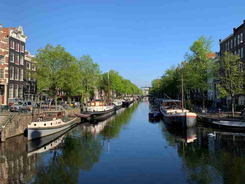
3. How Many Canals Are In Amsterdam?
A frequently asked question is how many canals there are in Amsterdam.
There are 165 canals in Amsterdam, totaling ± 75 km (± 46 mi). The number of canals in Amsterdam varies because sometimes a canal is turned into a road and vice versa.
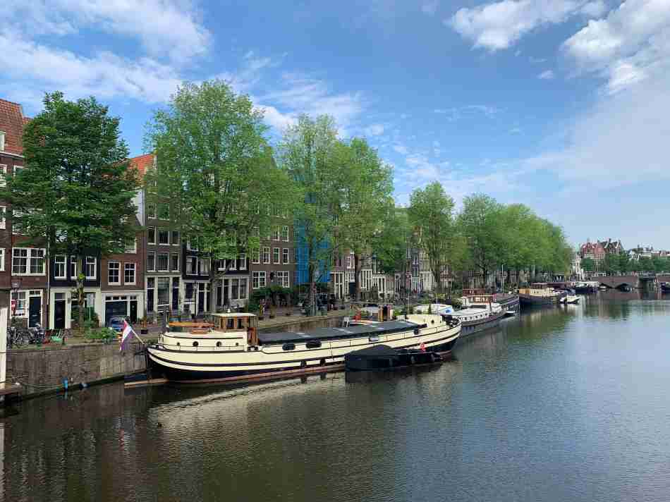
The Singelgracht is Amsterdam’s longest canal at 6.3 km (2.2 miles). The Singelgracht was dug for defensive purposes and was Amsterdam’s outer defensive parameter in the 17th century.
The Oudezijds Voorburgwal is the oldest canal in Amsterdam and dates back to 1385. The widest canal is the Keizersgracht, with 31 meters (33 yards).
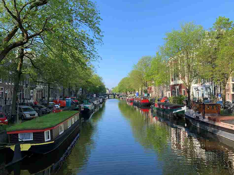
4. What Is The Most Beautiful Canal in Amsterdam?
In 2008, Amsterdam’s local newspaper, Parool, asked its readers what they considered Amsterdam’s most beautiful canal. Participants were all local readers of Parool, virtually all Amsterdam inhabitants. These locals knew all the canals of Amsterdam and could compare them like no one else.
The most beautiful canal in Amsterdam is the Brouwersgracht, selected by the locals.
The most beautiful canal in Amsterdam is the Brouwersgracht
The reasons that the Brouwersgracht was selected as the most beautiful canal in Amsterdam are:
- The beautifully restored canal houses along the Brouwersgracht.
- The picturesque views at the intersections with the main canals
- The graceful bridges over the Brouwersgracht.
- The narrow streets along the canal with little traffic
- The large trees directly along the water
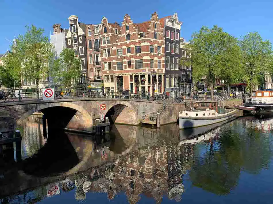
The Reguliersgracht is another photogenic canal that connects a number of the main canals. The Reguliersgracht is probably the most photographed Amsterdam canal due to its seven beautiful bridges in a straight line. Lovely for a daylight boat trip or a romantic evening walk.
The Reguliersgracht connects the three main canals, the Herengracht, the Keizersgracht, and the Prinsengracht. These three canals are all must-sees, but the Herengracht is the most beautiful. The mayor of Amsterdam lives and works at Herengracht 502.
The Herengracht was the canal where Amsterdam’s richest people lived. The canal houses along the Herengracht are stunning. Herengracht is still one of the most expensive and prestigious places to live in The Netherlands.
The Herengracht was the canal where Amsterdam’s richest people lived
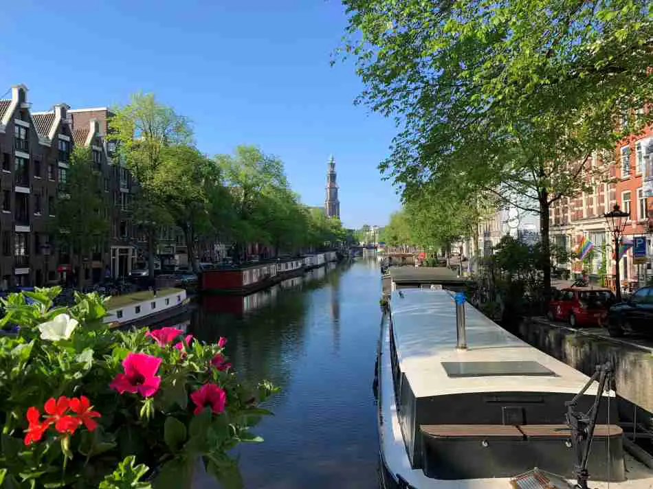
The Jordaan is a densely populated neighborhood with dozens of narrow streets and a handful of canals. The canals in the Jordaan are narrower than in other parts of the city. The Bloemgracht is the most beautiful canal of the Jordaan due to its gorgeous mixture of beautifully restored canal houses and elegant bridges.
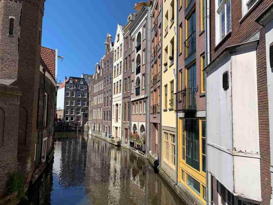
The Groenburgwal is a hidden gem of a canal in the middle of the center of Amsterdam. It is a short and narrow side canal of the Amstel River and intersects with the Amstel close to the Stopera. The Groenburgwal can best be admired from the Staalmeestersbrug, looking towards the Zuiderkerk (see below).
If you want to enjoy the beautiful canals, check out what a 3-day trip to Amsterdam will cost. You want to visit this mesmerizing city with fairytale-like canals at least once.
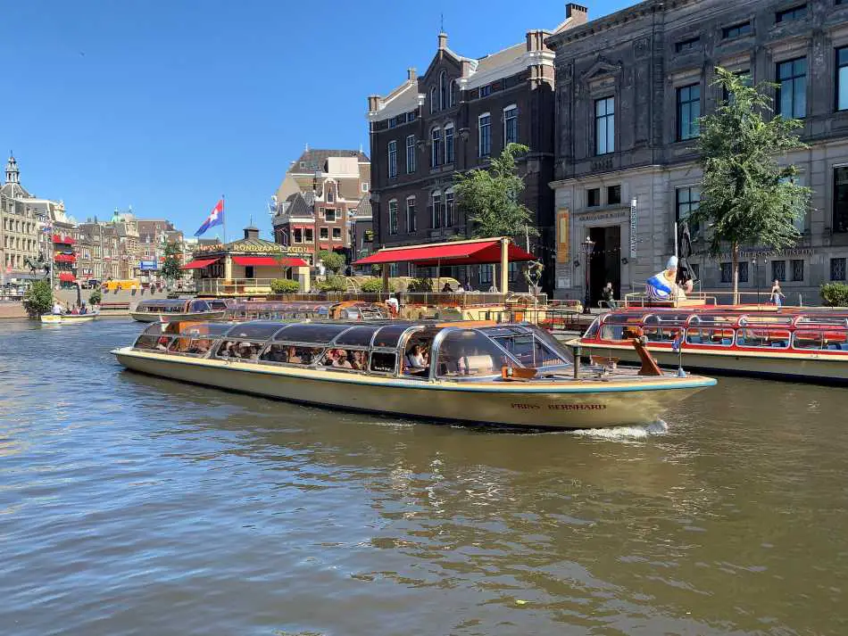
5. What Are The Best Amsterdam Canal Cruises?
Canal cruises are among the most popular Amsterdam attractions and are enjoyed by over three million visitors annually. There are dozens of cruises available, and there is enough competition to keep ticket prices reasonable.
In Amsterdam, there is no difference between the standard canal cruises of different cruise companies. They will sail through the same canals and show you the same highlights.
A standard canal cruise lasts ± 60 minutes and costs € 15-20 ($ 15-20), depending on the season.
In addition to a standard canal cruise, dozens of alternative canal cruises are possible, often with drinks and food. I love the evening canal cruises in Amsterdam in particular because Amsterdam looks a bit like a fairytale in the evening. Romantic dinner cruises and party cruises are also possible.
Check the canal cruise possibilities out in this overview of canal cruises in Amsterdam.
6. How Deep Are Amsterdam Canals?
You may wonder how deep are Amsterdam canals.
The canals in Amsterdam are 1.5-3.0 m (5-10 ft) deep, depending on their size. Typically, the wider the canal, the deeper it is.
Water levels in the Amsterdam canals are stable and tightly regulated, remaining between 0.3-0.6 m (1-2 ft) below sea level, even in heavy rains.
The larger canals in Amsterdam are deep enough to drown in if you can’t find a stair to get yourself out of the water again.
Unfortunately, this happens yearly with around a dozen drunk men who urinate in an Amsterdam canal and fall forward in the water.
Consider yourself warned….!
7. Are The Canals in Amsterdam Clean?
Many people wonder if the Amsterdam canals are clean enough to swim in.
The Amsterdam canals have become much cleaner over the last decades. The Amsterdam canals are now so pure that it is possible to fish in Amsterdam again. Nowadays, more people are swimming in the canals, although that is not officially allowed.
The discarding of sewage by the (oldest) canal houses and the many houseboats in the canals has stopped, significantly improving water quality.
Another major step to improving the canals’ water quality was to move the sewage plant to stop discarding purified sewage in the Amstel River. This step led to another significant improvement in the water quality of the Amstel River and Amsterdam canals.
Boats of the Amsterdam municipality constantly cruise the canals to remove floating trash
Boats of the Amsterdam municipality constantly cruise the canals to remove floating trash. As a result, the Amsterdam Authorities claim that the water in the Amstel River and canals now meets the standards of official bathing water.
Improving water quality has significantly increased the number and diversity of fish in Amsterdam’s canals. Keep in mind that you need a fishing permit in The Netherlands. The Netherlands is a highly regulated country. These days, you also see more and more people swimming in the Amsterdam canals, although that is not officially allowed.
The staggering number of bicycles still thrown into the canals remains. Every year, the municipality of Amsterdam removes around 15.000 bicycles from the canals. These bicycles were most likely stolen, and the thieves needed to get rid of them without leaving traces.
The large-scale theft of bikes is one of the most important problems in Amsterdam. Therefore, always lock your bike if you discover Amsterdam by bike.
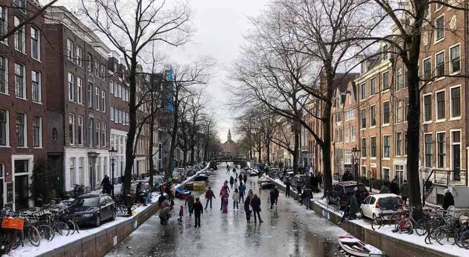
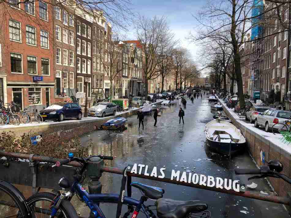
8. Do The Canals In Amsterdam Ever Freeze?
It seems impossible if you walk along the Amsterdam canals on a sunny summer day, but skating on the Amsterdam canals is sometimes possible.
In some years, the winter is severe enough for all canals in Amsterdam’s center to be frozen, and ice skating on the canals is possible. For example, in February 2021, ice skating on the canals in Amsterdam was possible after two weeks of ice-cold weather.
If the weather forecast predicts at least five days of freezing conditions, sailing with a boat in the canals will be prohibited. In addition, locks around Amsterdam are closed to stop the water currents and improve the canals’ ice quality.
Those severe winters are the best, and every Dutchman looks forward to skating on the canals again. Those winters will get us all very excited. Consider yourself lucky if you visit The Netherlands during an ice-cold winter because you will see an entire country celebrating.
Unfortunately, these severe winters are becoming very rare. The Netherlands has a moderate climate and relatively mild winters, and winters seem to be less severe. But every 5-10 years, like in 2021, we get lucky and enjoy ice strong enough to skate on the canals.
9. How Were Houses Built Between The Canals In Amsterdam?
Building houses between the canals was more complicated than you can imagine. The peatland between the canals was not solid enough to build houses on.
Fortunately, the peat layer under Amsterdam was only 8-9 meters thick, and under the peat layer were solid layers of sand.
Houses between the Amsterdam canals were built on long wooden poles, driven in the ground until solidly anchored in an underlying sand layer to provide a sufficient foundation for building a canal house. These wooden poles still support many of the houses in Amsterdam’s center.
The Dutch built houses in a peat swamp between the canals. A city in the middle of a peat swamp.
God created the world, but the Dutch created The Netherlands
Amsterdam’s 5-fold expansion between 1600-1700 turned Amsterdam from a small medieval city into one of the most important cities of its time. During this period, the famous concentric rings of canals were dug, giving the center of Amsterdam its current shape.
The Youtube video below, called Expansion of Amsterdam between 1600-1700, gives a fantastic impression of Amsterdam’s massive expansion during that century. Viewing this video gives you an excellent impression of Amsterdam’s rapid development during the Golden Age of Amsterdam in less than five minutes.
UNESCO considered Amsterdam’s canals so unique that the Amsterdam Canal District is now a UNESCO World Heritage Site.
Amsterdam was the capital of the world economy in the 17th century and was considered the ideal city. As a result, Amsterdam was a reference for building new cities worldwide until the 19th century.
The Amsterdam Canal District required expertise in hydraulics, civil engineering, town planning, construction, and architectural know-how
10. Why Were The Lakes Around Amsterdam Drained?
The canals were needed to drain the peat swamps. However, that was not the only problem with water that Amsterdam had to solve to exist.
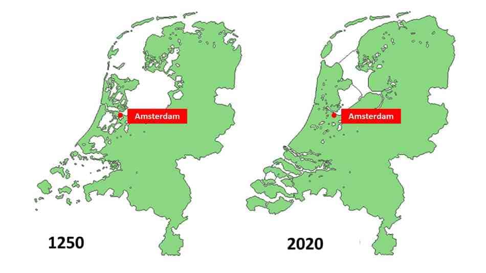
If you look at the map below, you will note many large lakes around Amsterdam before 1250 AC. These lakes rapidly grew by rapid erosion of the weak peat layers, threatening Amsterdam’s existence.
Drainage of these lakes became necessary to safeguard Amsterdam against the water threatening it from the outside. The Beemster Lake was the first lake drained in the early 17th century with the help of windmills. Over the following centuries, the Dutch drained many more lakes in the western part of The Netherlands.
The Beemster Polder is now another UNESCO World Heritage Site in The Netherlands. Almost all UNESCO World Heritage Sites in The Netherlands have something to do with water management. That is a central theme in a country that would not exist if it were not for its water management skills.
Almost all UNESCO World Heritage Sites in The Netherlands have something to do with water management